Heavy rain, large hail, gusty winds and tornadoes in the forecast
Please stay weather aware this Sunday!
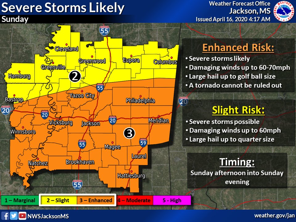
Please stay weather aware this Sunday!
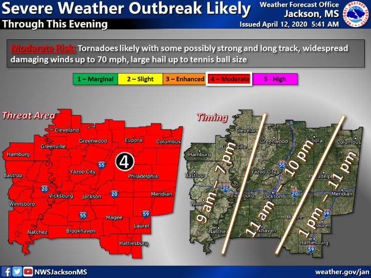
The latest forecasts from the National Weather Service in Jackson.
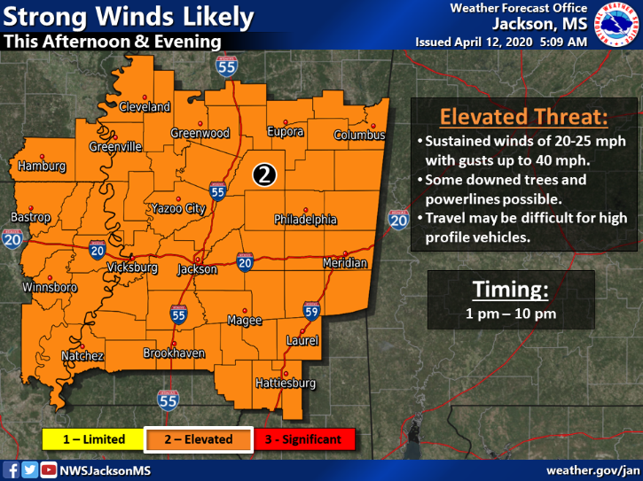
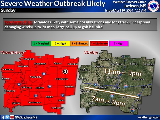
The National Weather Service in Jackson issued this forecast this morning (4/10):
A severe weather outbreak is looking likely Sunday morning through Sunday evening across the forecast area. Tornadoes are likely, some of which could be strong and long-tracked. Please continue to check the latest forecasts as timing, impacts and outlooks may change.
If the National Weather Service issues a Tornado Watch, the Adams County Safe Room on Liberty Road will open to anyone who needs shelter. Should the shelter open, please understand the following rules.
This weather system could cause localized flash flooding. If you come across a flooded road, ditch, or creek, turn around, don’t drown! A majority of deaths in flash flood situations happen when people get trapped in vehicles.
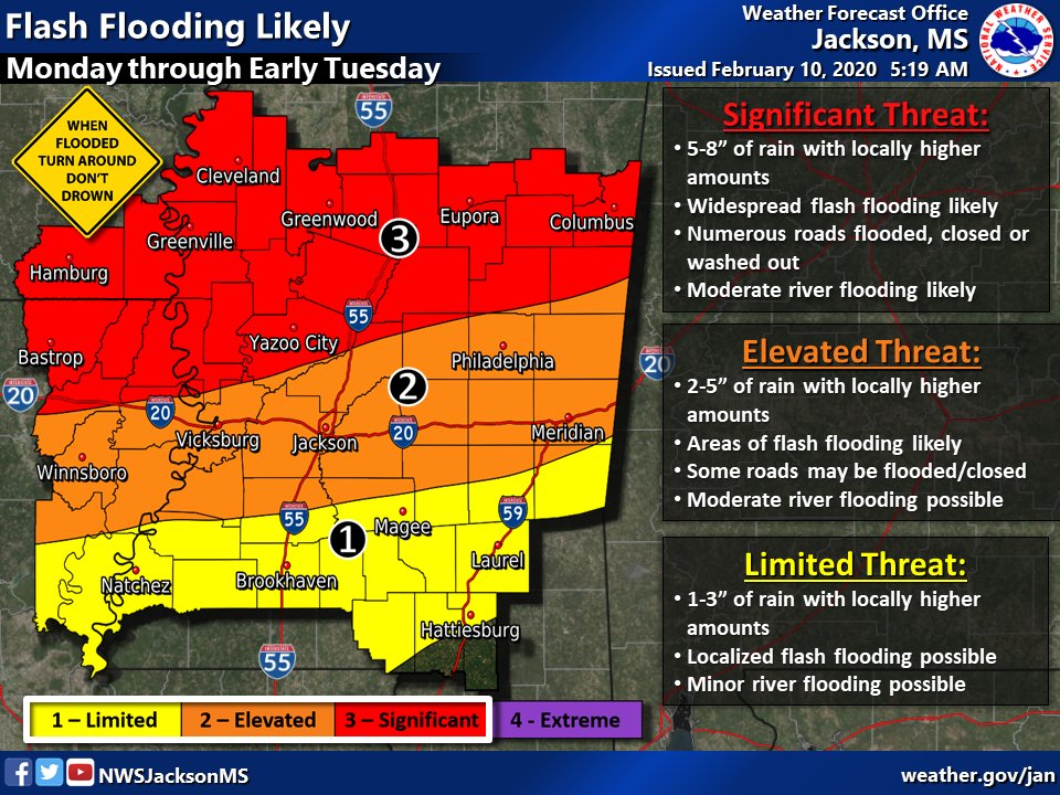
The National Weather Service in Jackson, Mississippi reports that an active weather pattern is moving through our area this week. Heavy rain, localized flooding, thunderstorms and isolated tornadoes are in the forecast through Thursday.
Stay weather aware, have a plan for shelter in case the weather gets severe, and never drive across a flooded road or around a barricade.

